Severe Flooding in Sydney Outskirts: Residents Evacuated
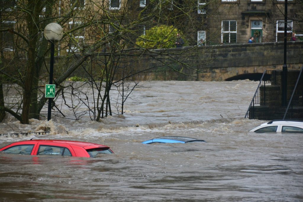
Residents of Sydney’s outskirts are currently facing a dire situation as flood waters continue to rise due to several days of heavy rainfall. In response to the escalating conditions, emergency warnings have been issued, and evacuations are underway for various areas along the Hawkesbury River.
Evacuation orders have been given for parts of Agnes Banks, Cornwallis, the eastern section of Richmond Lowlands, Pitt Town Bottoms, the northern part of Pitt Town (around Percy’s Place Caravan Park), sections of Cattai, Sackville, Cumberland Reach, and extending all the way down to Lower Portland.
The New South Wales State Emergency Service (SES) has reported 44 active warnings and has already performed 13 flood rescues. Overnight, from Saturday morning to Sunday morning, there were a total of 297 incidents recorded.
Flood Warnings and River Conditions
Prior to the heavy rainfall, the Bureau of Meteorology (BOM) had already issued flood warnings for the Nepean and Hawkesbury rivers. Other areas that are currently under flood warnings include the Cooks River, Georges and Woronora Rivers, Shoalhaven River, and St Georges Basin.
The BOM states that major flooding is possible along the Hawkesbury River at North Richmond, with moderate flooding already occurring at Windsor. Additionally, there is minor flooding peaking along the Nepean River at Penrith and the potential for flooding along the Hawkesbury River at Sackville.
Although the BOM has forecasted no further significant rainfall for the upcoming days, some river levels are still rising. Areas such as the Nepean River at Yarramundi, Grose River at Burralow, and the Hawkesbury River at Windsor are experiencing ongoing increases in water levels.
Regional Weather Forecast
New South Wales/Australian Capital Territory: Sydney is expected to have a partly cloudy day with a slight chance of showers and a maximum temperature of 21°C. In Canberra, the weather will also feature partial cloud cover with a slight chance of showers and a maximum temperature of 17°C.
South Australia: Frost warnings have been issued for the Mid North and Riverland districts, with temperatures dropping as low as minus one degree Celsius. Adelaide is forecasted to have a slightly cloudy day with a chance of drizzle and a maximum temperature of 16°C.
Victoria: Strong wind warnings are in effect along the East Gippsland Coast, extending into Sunday. Melbourne can anticipate a cloudy day with a possibility of morning fog and showers in the evening. The maximum temperature will reach 15°C.
Tasmania/Northern Territory/Queensland: No weather warnings have been issued for these states. Hobart can expect mostly sunny conditions, with a chance of cloudy weather later in the day. The maximum temperature will be 13°C. Brisbane, the capital of Queensland, will experience a sunny day with light winds and a maximum temperature of 22°C. Darwin City and the Outer Darwin area may be affected by areas of smoke haze, but overall, it will be sunny with a maximum temperature of 29°C.
Western Australia: Wind warnings have been issued for the Gascoyne Coast, Geraldton Coast, Bunbury Geographe Coast, and Leeuwin Coast. Perth is forecasted to have a partly cloudy day with a high chance of showers and a maximum temperature of 21°C.
This widespread flooding emergency has impacted the community significantly. Efforts from emergency services and authorities, including the SES, are in full swing to ensure the safety and well-being of all affected residents.